Monday, August 27, 2012

Navigating Physics - Strange Maps

Strange maps has a nice little piece up on a 1939 map of physics. I don't think I've ever wanted a map of non-spatial information more.  I want to travel down Electromagnetic River...I'll avoid Lake Radioactivity, though.

"This spatial representation of the subject, dating from 1939, defines itself as Being a map of physics, containing a brief historical outline of the subject as will be of interest to physicists, students, laymen at large; Also giving a description of the land of physics as seen by the daring sould who venture there; And more particularly the location of villages (named after pioneer physicists) as found by the many rivers; Also the date of founding of each village; As well as the date of its extinction; and finally a collection of various and sundry symbols frequently met with on the trip."

Strange Maps - 1939 Map of Physics 
 

Wednesday, July 25, 2012

Great Advice from @PetersonGIS

A wall of text does not get your point across.

My favorites:

#4 Make a dramatic graphic statement that looks different from the maps around you. This is a sure-fire way to get your map noticed.
#5 That drama needs to highlight your SINGLE teaching point

How to Design a Winning Map Poster

Monday, July 23, 2012

Historical Landsat Images

Wired is running a nice little article on some of Landsat's most significant images. 

From the shrinking Aral sea to the Kuwait oil fires see some startling imagery at:
Wired: Landsat’s Most Historically Significant Images of Earth From Space


Friday, June 1, 2012

Torch Spotting

Keep track of the Olympic torch as it travels through the UK with ESRI's latest story map.  It also references Flickr photo's tagged for the event to give you up to date pictures.

"Follow the Olympic torch’s journey around the United Kingdom

8,000 torch-bearers are carrying the Olympic flame through 1,000 cities and villages in England, Wales, Northern Ireland, and Scotland. Explore today’s and previous days’ photos of the relay; click on future locations (gray symbols) for dates."


Tuesday, May 15, 2012

"Cartographer's Toolkit" Getting Finishing Touches @PetersonGis

Very interested for this to be released.  It looks like Gretchen's new book will include her previous e-books "Colors For Maps" and "Type For Maps" with an additional chapter on patterns.  It will be nice to have them all in print (yes, I cling to outmoded tree-killing technology). 

Read about recent updates at Gretchen Peterson's blog.


Friday, May 11, 2012

A Map to Comfort

I promise this isn't advertising, just awesome stuff on the interwebs. 

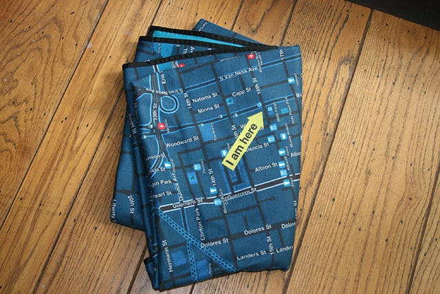
From (the appropriately named) The Awesomer you can get a custom printed map fleece blanket.  Pricey, yes. Awesome, yes.

Check out the Soft Cities fleece blanket (they make cloth napkins too) at The Awesomer.


Monday, May 7, 2012

Fate of the "Lost Colony"

Examination of a map held by British Museum, created in 1585 by Roanoke governor John White, has revealed what some believe is a new clue to what happened to the Roanoke "Lost Colony". Researchers have examined the area beneath two patches attached to the map. One of these patches appears to be a simple correction to the map, but underneath the other patch is a symbol denoting a fort. The patches appear to be contemporaneous with the rest of the map, and American and British scholars believe the fort symbol could indicate where the settlers went.

Full article at The Telegraph (http://www.telegraph.co.uk/science/science-news/9244947/Ancient-map-gives-clue-to-fate-of-Lost-Colony.html)

Monday, April 30, 2012

Tell a Story Through Maps

Recently launched mapstory.org allows users to created animated maps.  Can't wait to see all the MapStories that are created, it should be engaging and informative. 


Play With Maps - Google's Map Labyrinth Game (Cube)

Google Cube is live. Looks like you need Chrome to play with it, though.

Cube: A Game About Google Maps -- http://www.playmapscube.com/


Wednesday, April 25, 2012

Mexican "Geolocalization Law"

The gov't claims it's to aid in the war on drugs, but is it a severe privacy infraction?

"Last week, revisions to Mexican federal law took effect that give public authorities and law enforcement unprecedented ability to compel mobile phone companies to disclose real-time geographic data from mobile phone companies in a wide variety of cases."

Full article at Ars Technica: Mexican "Geolocalization Law" draws ire of privacy activists